Just a simple activity using a tech tools to enhance student understandings.
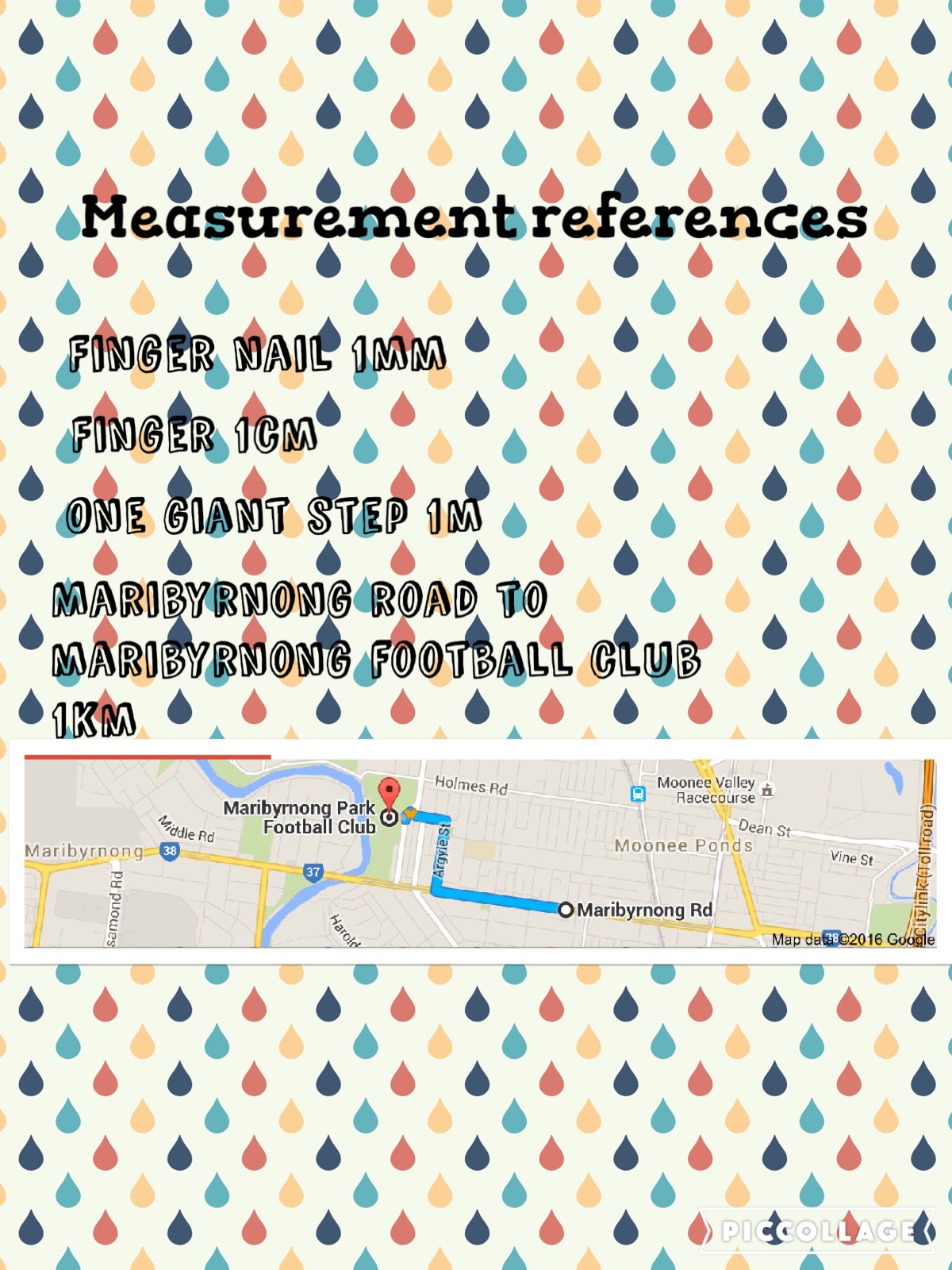
This week I have been working on area and perimeter with my 4/5s. This has included a lot of estimation. It became clear early on that students were unsure how to estimate common units for measuring length (i.e. mm, cm, m km). To provide a reference point for estimation, I asked students to create a poster for themselves to be able to remember the sizes of these measurements, with the intention that this would make it easier for them to estimate with a visual cue. Most chose to use the app Pic Collage to display their work.
For example, to remember the size of 1 millimetre, some students took a photo of the thickness of a fingernail. For 1 metre, they referred to the length of a classroom table.
Kilometres proved to be difficult as it is a difficult distance to visualise. So we used Google Maps to experiment with distances and see a visual representation of exactly how far 1 kilometre is. Students found a familiar local point on Google Maps and used the directions function to map the journey to another familiar location that was 1km away (for example, the local Coles or skate park).